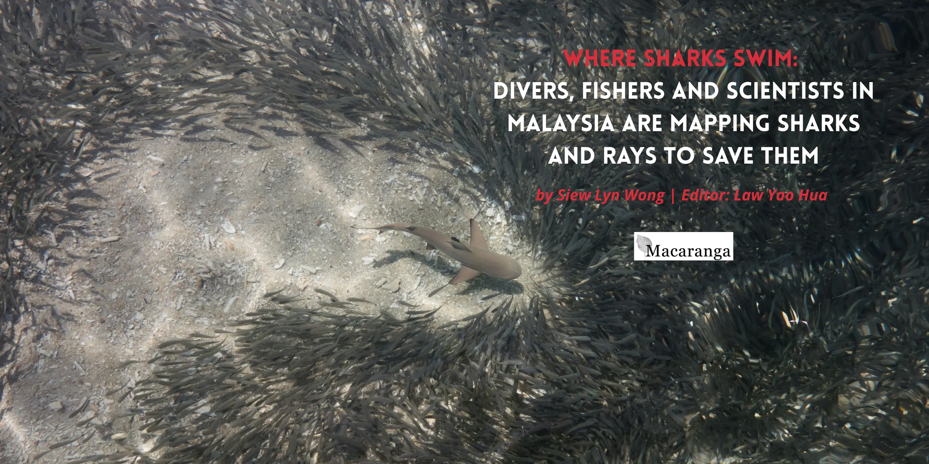
The coral reef wall at Hanging Garden, Sipadan, is colourful, popping with yellow crinoids, purple table corals and orange-and-white clownfish. But the scuba divers ignore it. Instead, they drift in the deep blue, away from the reef that plunges to a depth of 600 m.
Suddenly, they see them, a shiver of sharks with unmistakable hammer-like heads. And the divers whoop in celebration.
Every year between July and November, groups of magnificent Scalloped Hammerheads (Sphyrna lewini) swim through here and South Point, two dive sites south of this Sabah island. On average, the sharks are in groups of 40. It is a spine-tingling sight. No wonder the divers whoop.
Hammerheads are known to be migratory, but why they keep appearing here, where they come from, and where they are heading, remain puzzles to be solved.
Still, their regular aggregation here alone has put Sipadan on a new global conservation list. The list of Important Shark and Ray Areas (ISRAs) comprises critical habitats of sharks and their relatives, rays, and chimaeras.
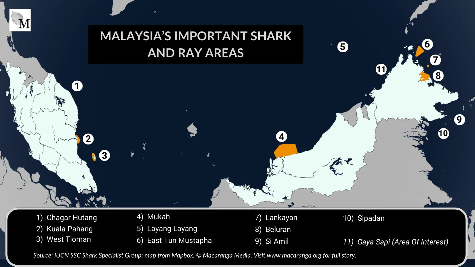
Malaysia’s 10 ISRAs comprise the expected, such as the Coral Triangle islands and the surprising, such as Kuala Pahang. Explore them all in Macaranga’s interactive ISRA map.
“This compilation of information at the species level and considering science-based criteria is the first attempt to ‘put sharks on the map’,” says Dr Rima Jabado, Chair of the IUCN Species Survival Commission Shark Specialist Group. These fishes are going extinct fast, second in scale globally only to amphibians. The Group developed the ISRAs to try to halt the loss.
Though not yet 2 years old, the approach is already seeing results. “ISRAs are being considered in marine spatial planning,” says Jabado. “They are being prioritised for monitoring and enforcement of protected areas. Some areas have led to the protection of species nationally.”
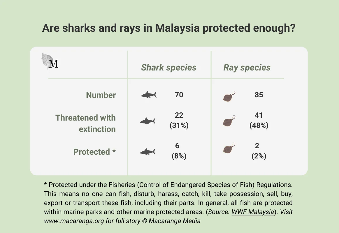
And since April, Malaysia has been part of that list with its 10 ISRAs, including Sipadan. This is critical for Malaysian sharks and rays: scientists warn that too many are ending up in fishing nets and soup bowls, as well as on charcoal grills. But officially, Malaysia denies the existence of targeted shark fishing. Instead, the government considers sharks as bycatch, caught by accident.
Hence, it is crucial to identify the areas that endangered sharks and rays use.
“There is so little data, information, and research on sharks and rays in critical habitats in Malaysia,” says WWF-Malaysia’s Serena Adam. As a IUCN SSC Shark Specialist Group member, Serena coordinated the Malaysian ISRA listings.
“I’m still surprised that all the 10 areas we proposed were approved. The ISRA criteria is very tight.” Nine proposed sites made it as ISRAs; the remaining one designated as an Area of Interest could be upgraded to an ISRA with more evidence.
The IUCN criteria are built on “the complex behaviours, ecology, and biological needs of sharks including species’ vulnerability, range restriction, key life-history activities, distinctiveness, and diversity”, according to the ISRA portal.
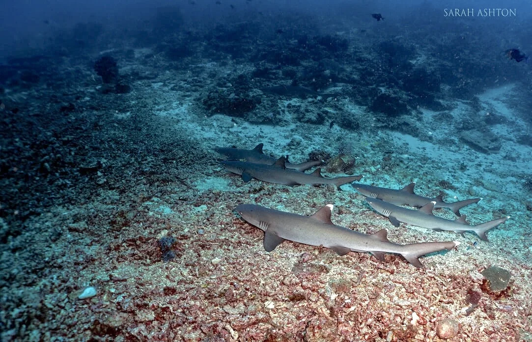
1) Whitetip Reef Sharks rest in groups safely in Sipadan. Photo: Sarah Ashton/Proposal Submission for ISRA listing of Sipadan, 2024
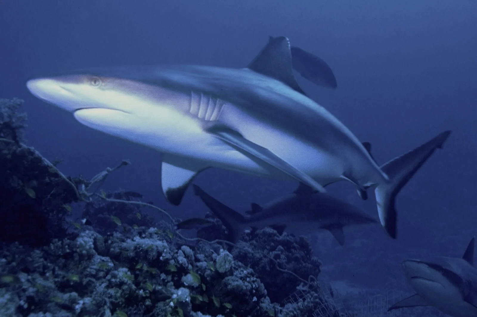
2) Grey Reef Sharks reproduce in Sipadan waters. Photo: Albert Kok/Wikimedia Commons
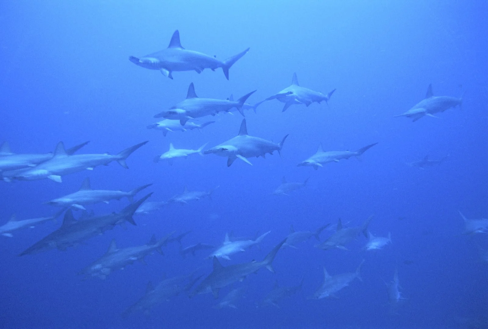
3) Sipadan is recognised for schools of Scalloped Hammerhead Sharks like these. Photo: Scubazoo.com.my
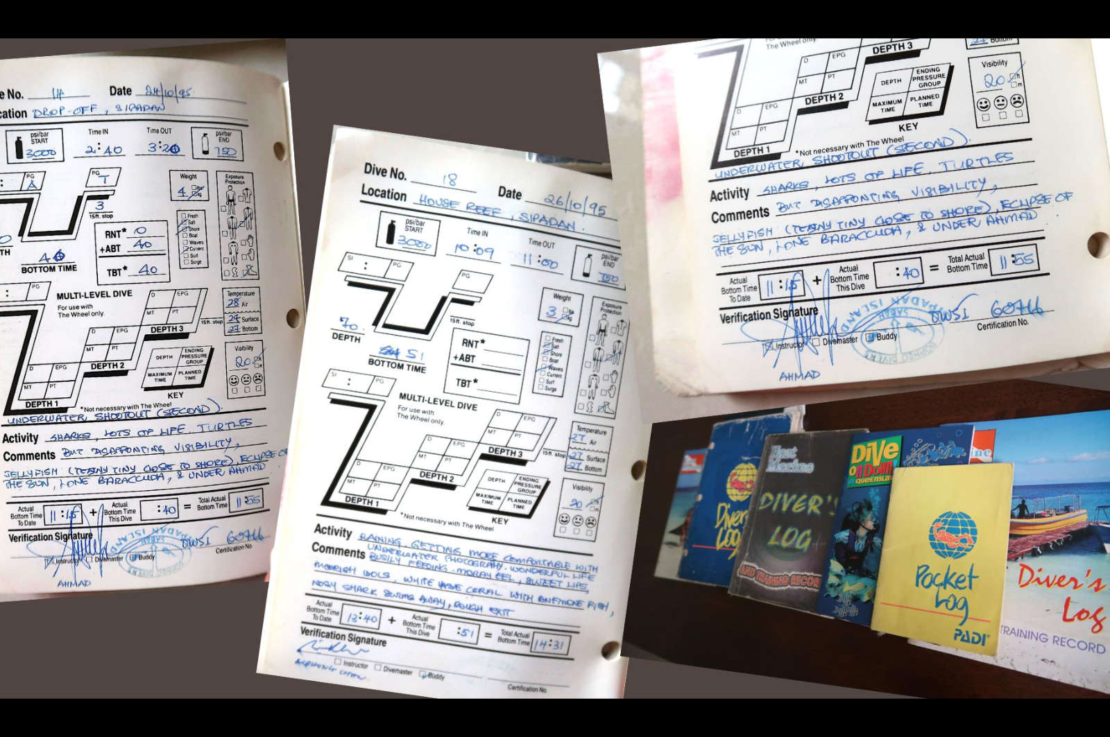
4) A sample of old dive log books with Sipadan entries. Photo: Sarah Irdina via Macaranga
The Sipadan ISRA, for one, meets several criteria. Vulnerable species visit the area for essential phases in their life history. The critically endangered Scalloped Hammerheads aggregate in Sipadan; the endangered Grey Reef Sharks (Carcharhinus amblyrhynchos) reproduce there; and the vulnerable Whitetip Reef Sharks (Triaenodon obesus) breed and rest in groups there.
Meeting each criterion demands robust scientific evidence. Obviously, it will not do to hang about in the deep blue in Sipadan, willing Hammerheads to appear. But dive operator Scuba Junkie SEAS actually did something with these experiences.
Between 2010–2019, they kept a detailed logbook of species sightings by their dive masters and customers. Logging ensures better service by underwater tour guides, dive tourism being an important, lucrative industry.
In all, they logged a whopping 13,308 dives. This data helped Sipadan qualify as an ISRA.
Global Acknowledgement
“It is heartening to know that [Sipadan] now has formal recognition from world experts as a vitally important habitat for the shark species using it,” says Dr Catherine McCaan, a marine biologist who was conservation manager of the outfit then.
“So far, the bulk of this has come from simple sighting data in divers’ logbooks. Hopefully, with this formal recognition, more targeted research will be carried out that would lead to the development and implementation of a long-term monitoring strategy.”
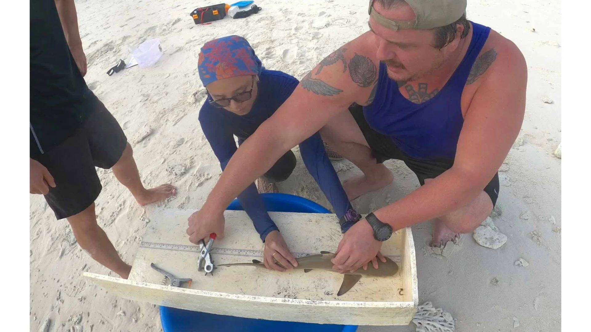
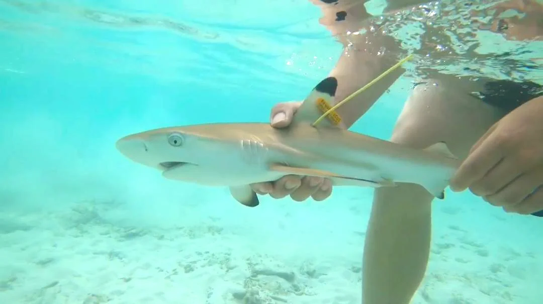
(1) Shark scientists Serena Adam and Nicholas Tolen measure and tag a juvenile Blacktip Reef Shark captured at Chagar Hutang as part of a Mark and Recapture study. Photo: Faqih Akbar via Macaranga
(2) A newly tagged juvenile Blacktip Reef Shark is released at its initial capture site at Chagar Hutang, part of a Mark and Recapture study. Photo: Nicholas Tolen via Macaranga
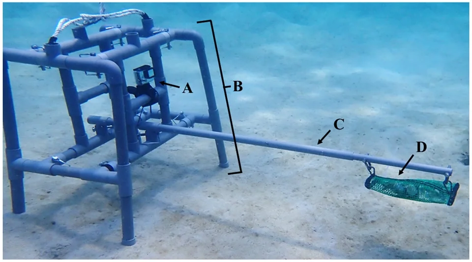
(1) A BRUV device: (A) GoPro Hero 8 camera (B) weighted PVC frame (C) meter-long bait arm (D) 500 grams of oily fish bait, designed to attract juvenile Blacktip Reef Sharks into the camera’s field of view. Photo: Nicholas Tolen via Macaranga
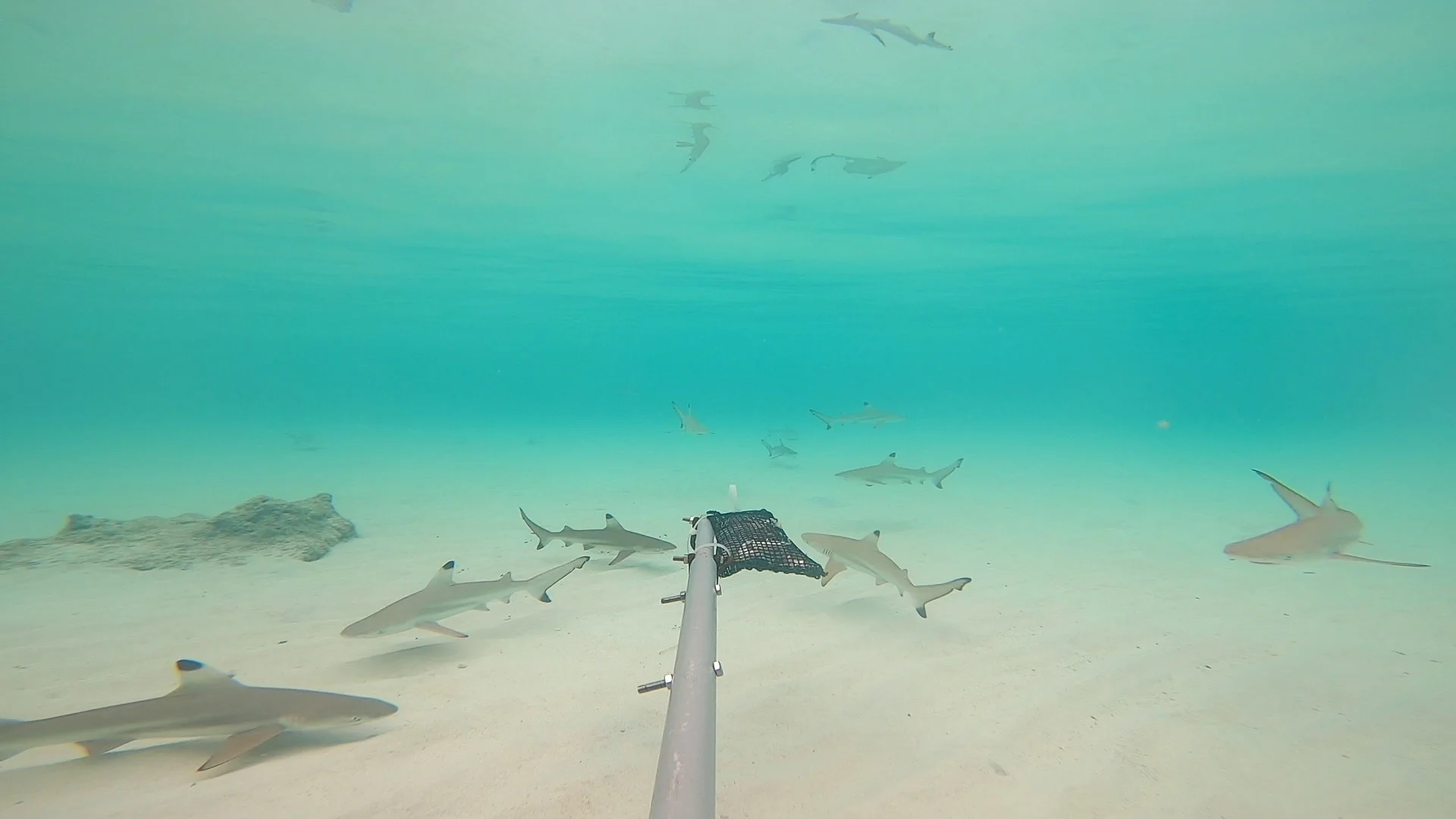
(2) 10 juvenile Blacktip Reef Sharks are captured on camera in the Baited Remote Underwater Video (BRUV) survey at Chagar Hutang. Photo: Nicholas Tolen via Macaranga
Citizen data like this was used as evidence for the listing of half the Malaysian ISRAs, says Serena. Social media was another important source of photos, videos and posts by divers, snorkellers, tour boat operators, and recreational anglers. The Malaysian team combed through hundreds of visuals and write-ups online to support their site proposals.
Why did they source data from the public?
To begin with, Serena says that too few scientists are working on sharks to produce enough data.
“But the main challenge was to fit what we had researched so far into the criteria,” says the shark and ray conservation officer. Scientists had mainly focused on fish landings in boats and at jetties. “So you know what is being caught but not where it is being caught.”
And even when scientists use underwater camera traps in specific locations to record sharks and rays, often, “we don’t have enough to tell exactly what they are doing there”.
Therefore, “we have to use complementary methods to find out what’s going on.”


(1) A neonate Scalloped Hammerhead is identified by its umbilical scar. Photo: Irsyad Pishal via Macaranga
(2) Scalloped Hammerheads are 45-50 cm long at birth, grow quickly and hang around coastal waters. Photo: Amanda Leong via Macaranga


(3) Mukah’s fishers shared their ecological knowledge of Scalloped Hammerheads and this helped this ISRA get listed. Photo: Muhammad Khairi Ismail IG via Macaranga
(4) Fishers’ catches are the main way to determine that a site is important for juvenile Scalloped Hammerheads. Photo: Mazidi Abd Ghani/WWF-Malaysia
In Mukah, Sarawak, coastal-marine researcher Dr Amy Then not only looked at shark and ray landings, she interviewed fishers who shared decades-long catch history and pinpointed exactly where they set their nets. This local ecological knowledge was what got Mukah designated as an important breeding site for Scalloped Hammerheads.
“For us to discover neonate sites – newborns – it’s really not common knowledge at all,” says the UM associate professor. “It’s only something that fishers who go in and out every day will know. Nobody dives in Mukah, so those things don’t get mapped.”
Science-Friendly Fishers
In Sabah, cooperating trawler fishers were what got East Tun Mustapha and Beluran ISRA status. Their respective delineation was based on images from cameras installed on trawlers by the Marine Research Foundation (MRF). The cameras took photos every 3 seconds, and using their GPS location and time stamps, scientists could map the ISRAs.
MRF conservation officer Ho Kooi Chee says, “Once [fishers] realised that we were keeping their identities and boat numbers anonymous, they gradually accepted the project and assisted in deploying the cameras.” They even spread the word among other fishers to allow cameras to be deployed.
Such buy-in from fishers might augur well for tighter conservation measures. Based on this evidence, MRF’s proposal to temporarily exclude fishing in East Tun Mustapha has been accepted by the Department of Fisheries Sabah, says Ho.
(1) Fishers allowed scientists to set up cameras on their trawlers to collect scientific data on their catches. Photo: Marine Research Foundation
(2) The cameras are GPS-linked and provided accurate location and time data for each catch. Photo: Marine Research Foundation
(3) The cameras confirm that East Tun Mustapha is an ISRA for critically endangered Bottlenose Wedgefish (Rhynchobatus australiae). Photo: Marine Research Foundation
(4) East Tun Mustapha is also an important site for Scalloped Hammerheads to reproduce. Photo: Marine Research Foundation
To aid in such decision-making is precisely the aim of ISRA listings.
“It will help highlight these areas’ importance,” agrees Izarenah Md Repin from the Department of Fisheries Malaysia fisheries conservation and protection division.
“And it can be a reference and strengthen justification for the government to potentially protect an area.”
She adds that ISRAs’ scientific basis and global recognition save the government time in identifying protected areas. Malaysia wants to double its marine protected areas (MPA) to 10%.
More Protection Needed
Only 6 ISRAs overlap with MPAs. East Tun Mustapha will need additional attention, says MRF’s Ho, as it is a transboundary area with the Philippines.
“Also, ISRAs in protected areas like Tioman strengthen and justify the importance of existing MPAs, and their effectiveness in protecting sharks and rays,” says Izarenah. The West Tioman ISRA recognises aggregations of the critically endangered Bottlenose Wedgefish (Rhynchobatus australiae).
While holding much promise, ISRA listings are just the beginning. To properly manage them, every scientist who contributed to the listings advocates continued research and long-term monitoring.
Si Amil, Sabah, met the ISRA criteria with proof that threatened Shorthorned Pygmy Devil Rays (Mobula kuhlii) aggregate regularly there, sometimes up to 100 individuals (Video from proposal submission for ISRA listing for Si Amil, 2024)
In Sipadan, the fact that no one knows why the Scalloped Hammerheads aggregate, means more studies need to be done, says McCaan, co-founder of the Sea Collective. “This information could in turn feed into conservation measures for the animal, which could have far-reaching implications worldwide.”
The overall challenge, says Then, is that “different areas have recognitions for different species, and different species also have very different biology.” She reckons that some habitats might be more critical than others, for example, for neonates and feeding.
Serena is hopeful that the listing will attract research funding. For both her and Then, the listing exercise has also been personally meaningful.
Purposeful Research
“As scientists collecting data, we want data not just to remain as data; we want it to translate into something useful,” says Then.
For Serena, working on ISRAs “is a turning point”. Future studies must answer several research objectives, she says, not just to determine species and population size.
“I would design our research to answer key criteria that’s needed for ISRA qualification such as predictable presence of species in the area, and what behaviour do they exhibit (ie. feeding, resting, courtship). Without these other aspects, you’re losing out information that is required to delineate – and better protect – an area.”
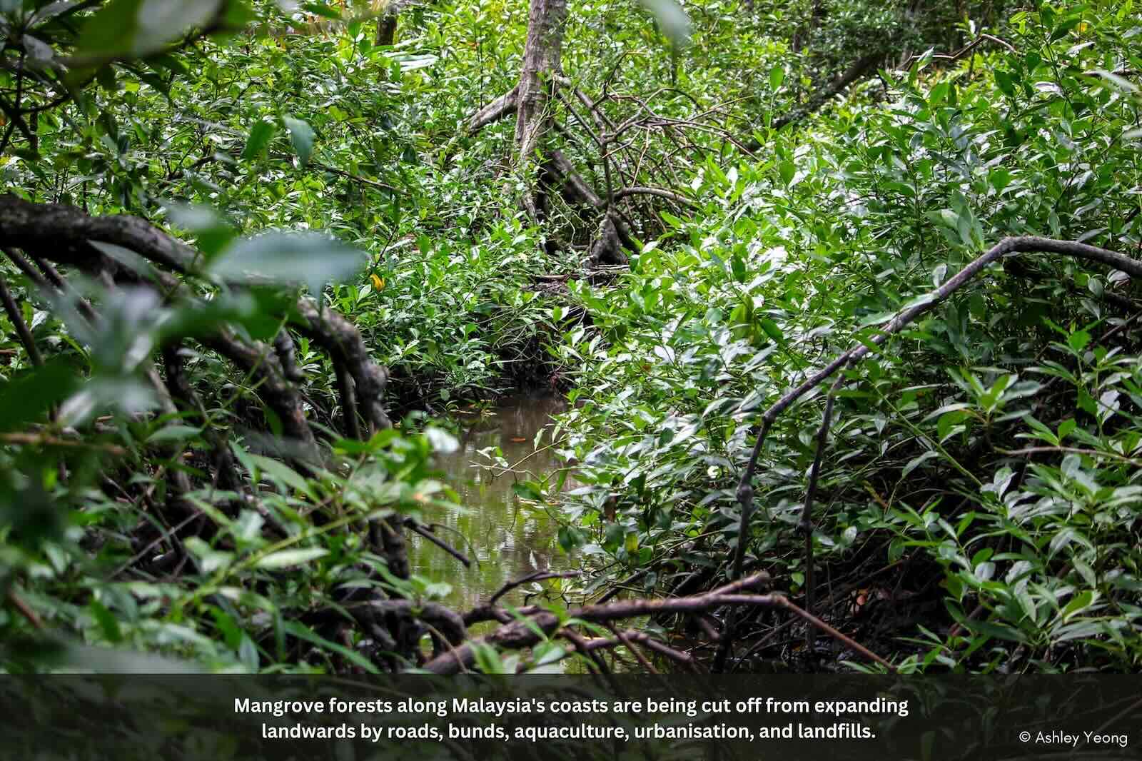
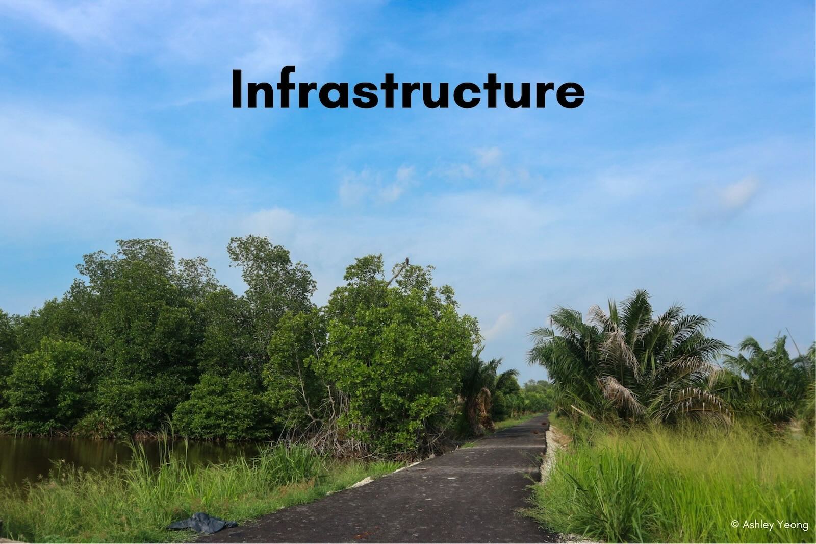
It looks like a mess but the dense, interlaced roots and branches of mangroves are what make them so mighty: a shield against the tides that would otherwise inundate the lands and drag shores back to the wider ocean. Living between sea and land, mangroves are called coastal forests. But in reality, they link and transition all the way inland to dryland forests. Or they did.
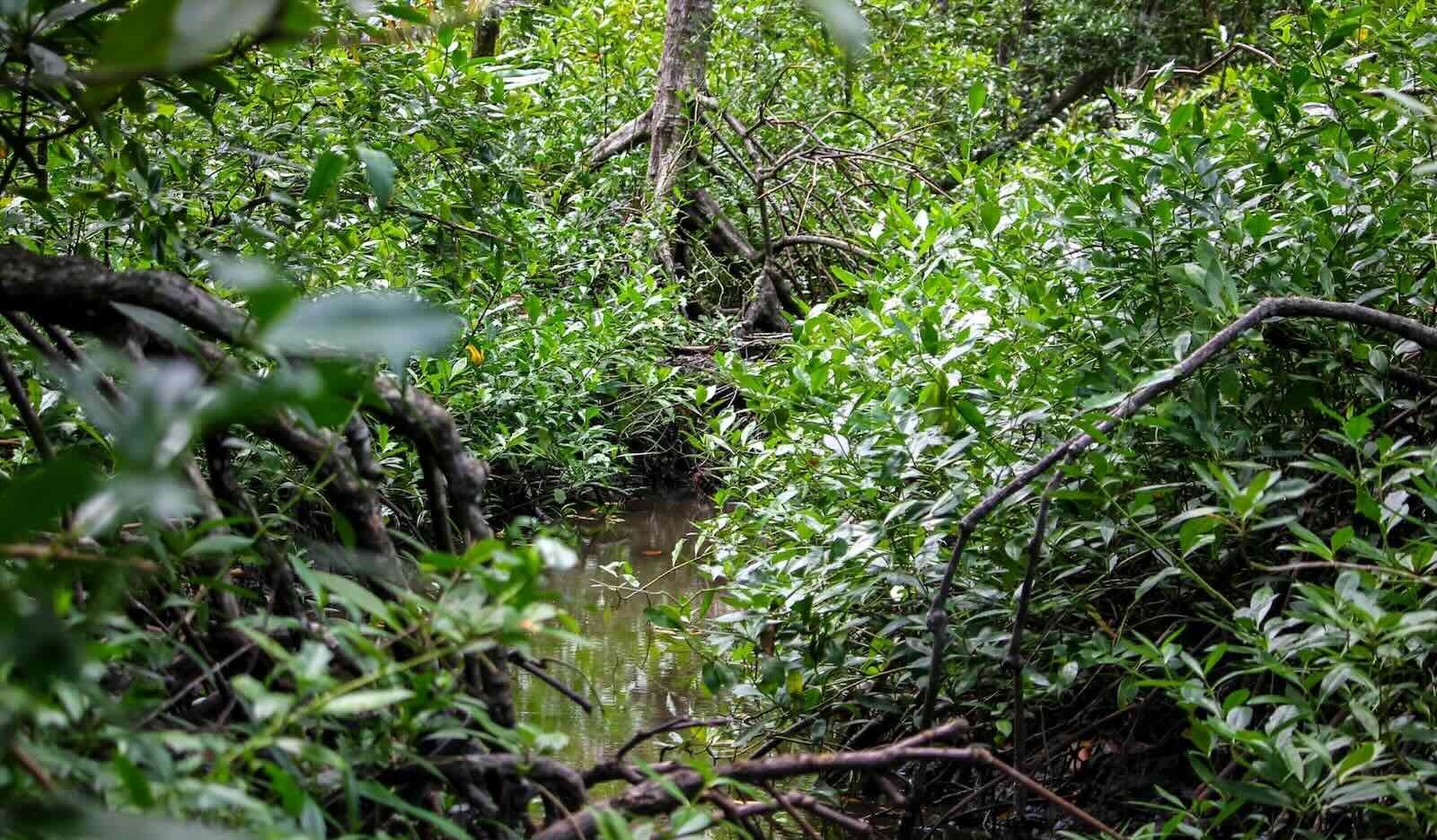
Mangrove forests along Malaysia’s coasts are being cut off from expanding landwards by roads, bunds, aquaculture, urbanisation, and landfills. Photo: Macaranga
In many parts of Malaysia, they no longer do. This makes coastal communities more vulnerable. And it is the birds that are signaling the loss of mangroves – with their absence.
No More Nuthatches
Take the Velvet-fronted Nuthatch (Sitta frontalis). This blue beauty looks like it can defy gravity by walking down vertical tree trunks thanks to powerful curved claws. But this mangrove resident “has been pushed out from, for example, nearly all of the Selangor coast, by bunding and clearance of that vegetation zone,” says eminent ornithologist Dr David Wells.
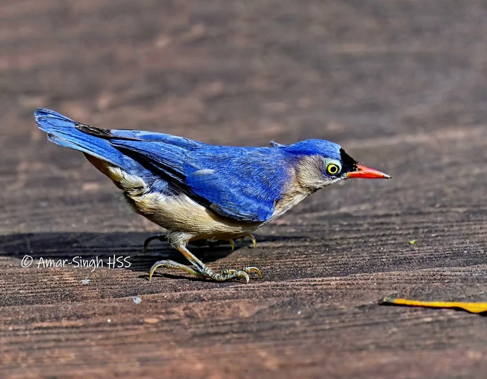
The Velvet-fronted Nuthatch (Sitta frontalis) is absent in many mangroves in Selangor | Photo: Amar-Singh HSS via Macaranga
Of note is that the bird relies on what are called back mangroves. This is the landward section of the mangrove ecosystem where it transitions to non-mangrove forests. “In my estimation, back mangroves are critical to at least half of all mangrove-recorded birds. Their loss is out of all proportion to their relative area,” says Wells, who has an encyclopedic knowledge of birdlife in the region.
Generally, mangroves are not immediately associated with birds. But mangroves in Malaysia support at least 144 species of birds, both resident and migratory. In turn, birds help sustain the ecosystem.
These birds depend on mangroves as a habitat, a rich food source and a breeding ground, says the Malaysian Nature Society (MNS) in its publication ‘Birds of rehabilitated mangrove sites in Selangor’. The dense branches and tangled roots of mangroves provide nesting sites, shelter from predators, and roosting areas for both resident and migratory birds. Mangroves teem with life. Fish, crabs, and insects thrive in the shallow waters and amongst tree roots, providing a plentiful food source for wading birds, herons, and fish eagles.
Additionally, mangrove trees themselves produce fruit and nectar that some bird species consume. The richer and more diverse a mangrove habitat, the richer and more diverse the birdlife. In turn, birds contribute to mangroves in a number of ways. This includes pollination, seed dispersal, pest control and providing nutrients via bird droppings. In Peninsular Malaysia, sunbirds are a major pollinator of the Bruguiera mangrove species, says avian ecologist Richard Noske.
Famously, coastal mangrove regions are “important staging and wintering sites for waterbirds,” says MNS. The north-central Selangor coast is recognised as an Important Bird and Biodiversity Area and is located along the East-Asian-Australasian Flyway. This bird migratory route stretches from Russia all the way down to New Zealand. Specifically, mangroves are “much preferred by wintering shorebirds, herons, egrets and storks because of the strategic location that allows easy access to adjacent tidal mudflats as their foraging sites during low tide”.
But unlike mudflats and the seaward fringes of mangroves, the interiors of a mangrove ecosystem are shrouded in obscurity.
From the air, the extensive mangroves of Matang Mangroves are breathtaking (Video: Ahmad Aldrie Amir)
How Mangrove Zones Work
In Peninsular Malaysia’s largest mangrove forest, when one moves from land to water, “you can see the terrain is starting to change,” says mangrove ecologist Dr Ahmad Aldrie Amir. These are the Matang Mangroves in Perak. Stretching in a crescent, their almost 41,000 hectares of area have been protected and managed for 122 years.
The ecosystem is complex, but as the scientist points out, it is possible to roughly make out the succession of zones from the ‘true’ mangrove species seawards to the mixed dryland forest inland dominated by ‘associate’ mangrove species. The key is how much seawater reaches the various zones.
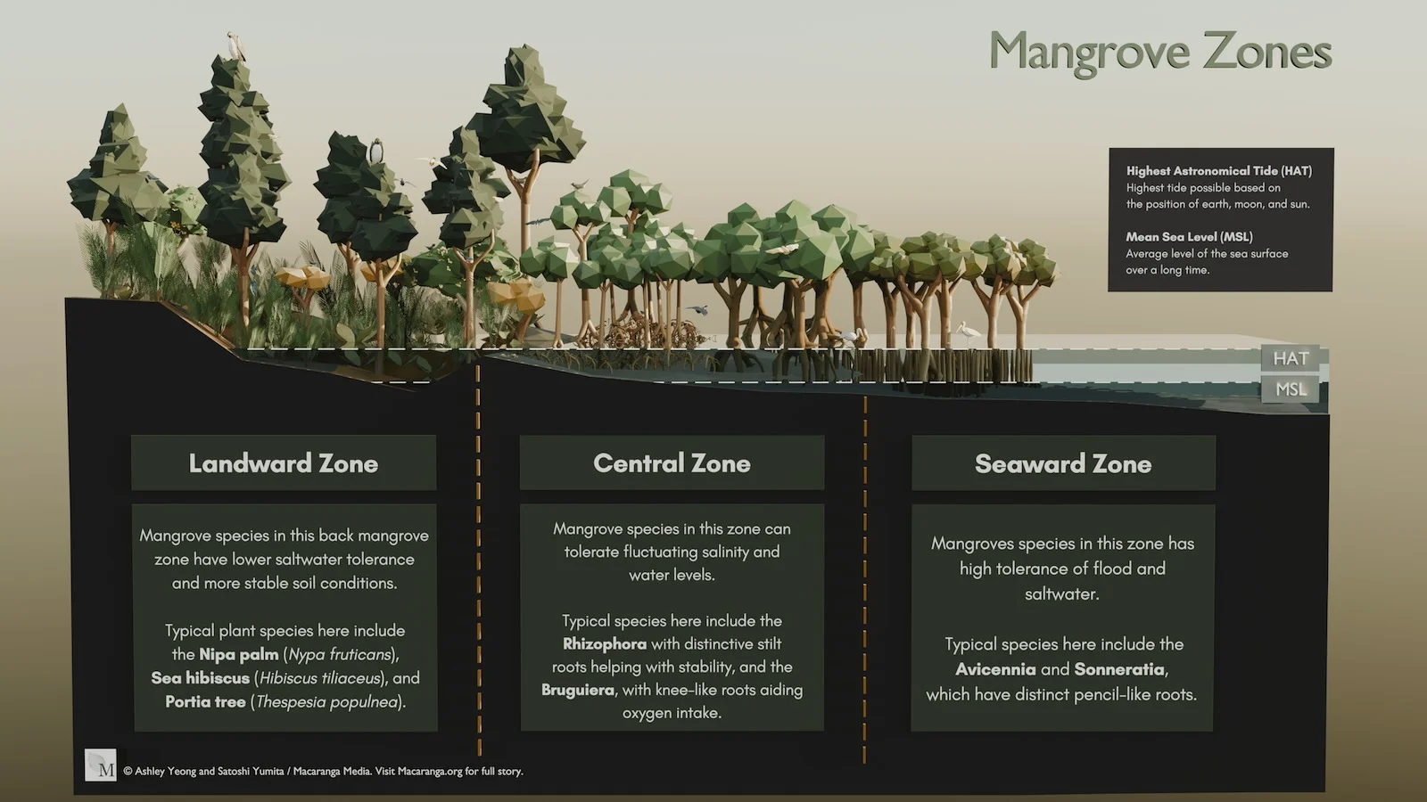
Facing the ocean and awash in 100% salty seawater are hardy species like Avicennia and Sonneratia. These trees are distinguished by their ‘pencil roots’, sticking vertically out of the sand and mud to breathe oxygen. They are called pioneer species because they ‘grow’ land by colonising new deposits of sediment.
Behind the seaward zone is the central zone, dominated by Rhizophora species. Inundated daily by seawater, their tangled web of aerial roots elevate the plants above the saltwater and allow them to ‘breathe’ even while their lower roots are submerged. Moving landward, Brugueira species with their buttresses and knee-shaped roots tend to dominate.
This zone melds into the back mangroves or landward zone, which is influenced by freshwater and is inundated only by the highest tides.
This is where the most diverse communities live, comprising mangrove and mangrove-associates plants. Among them are the Acrostichum, Acanthus, Excoecaria, and river-fringing Nypa fruticans. This zone is also richest in bird numbers and diversity, says ornithologist Wells.
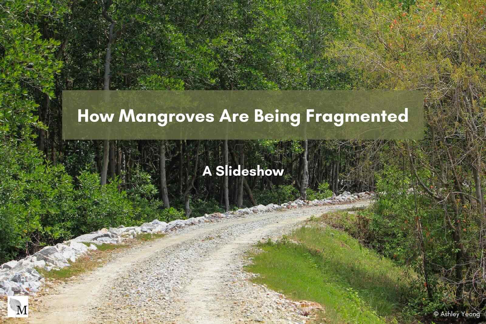
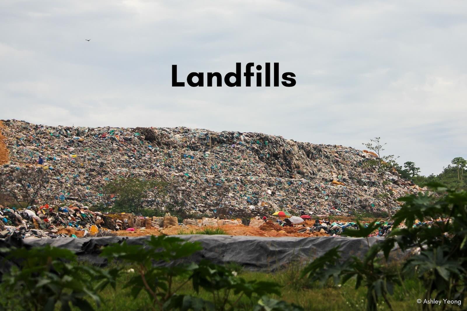
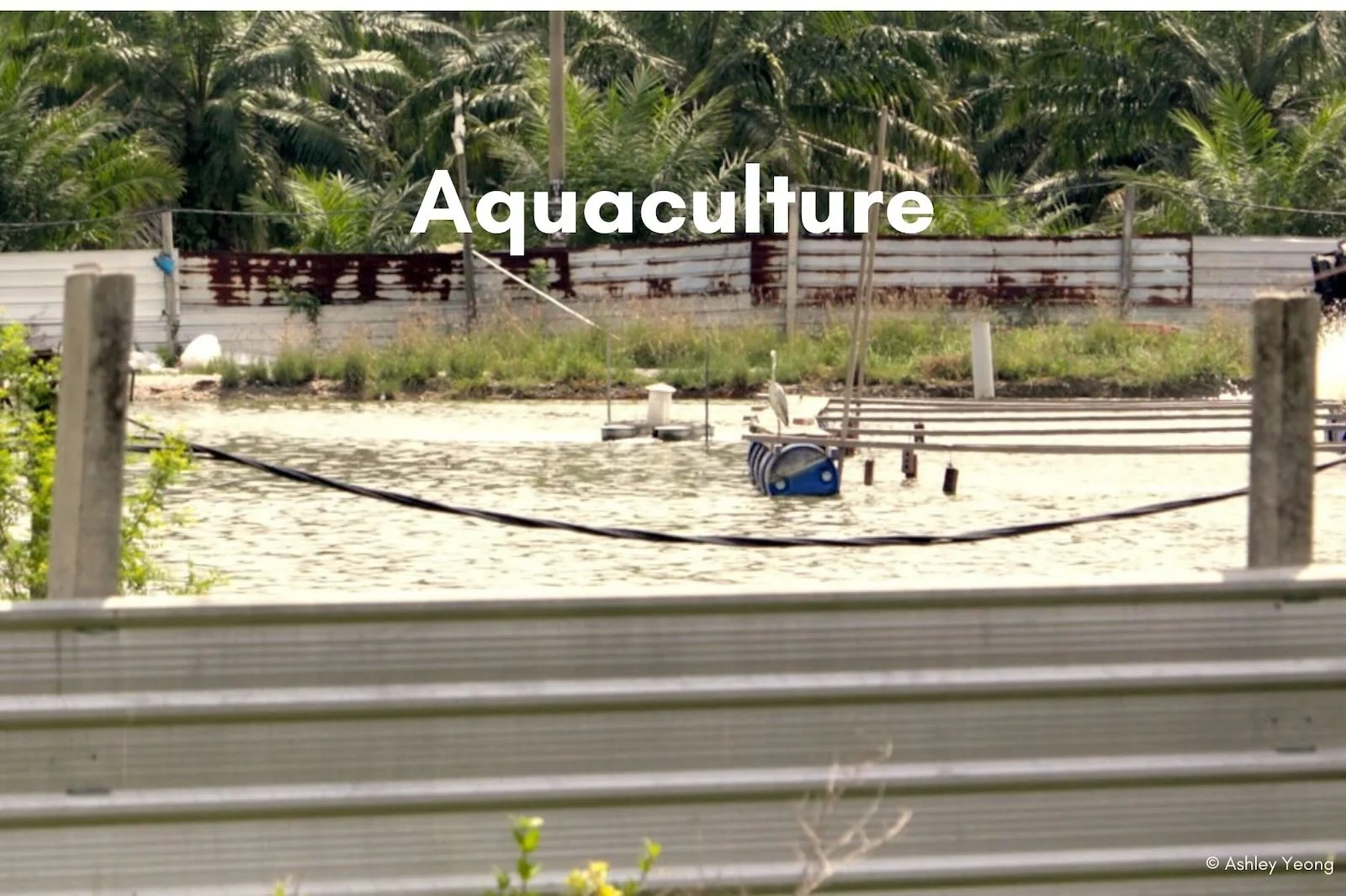
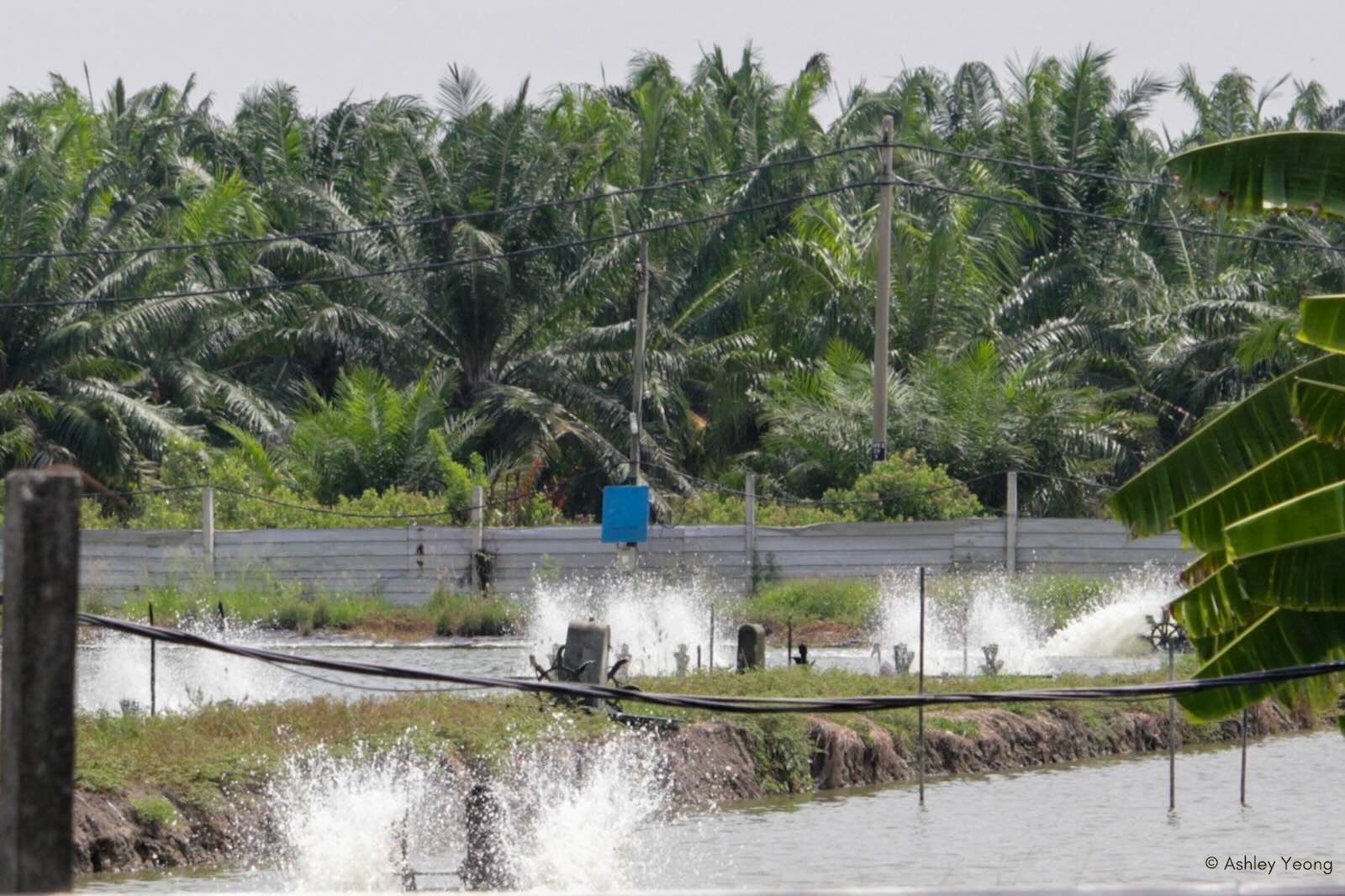
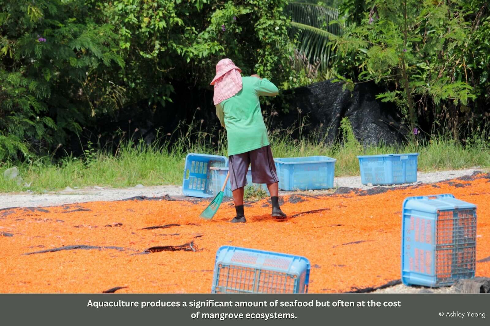
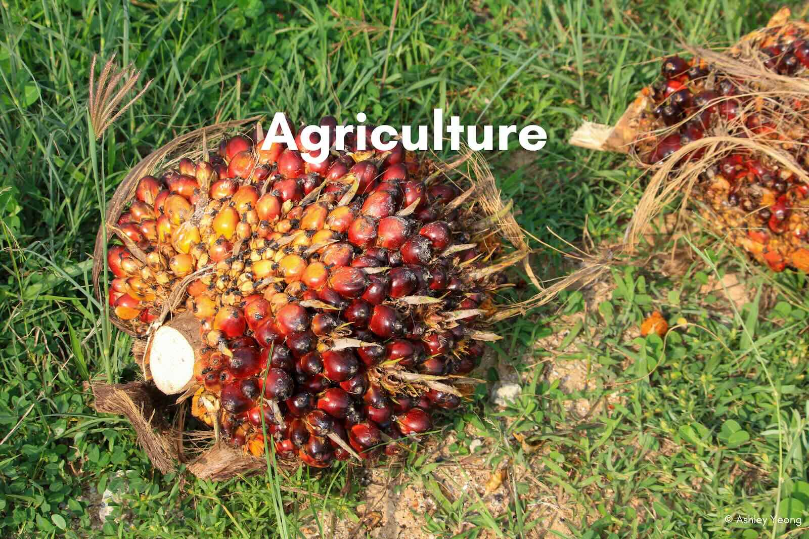
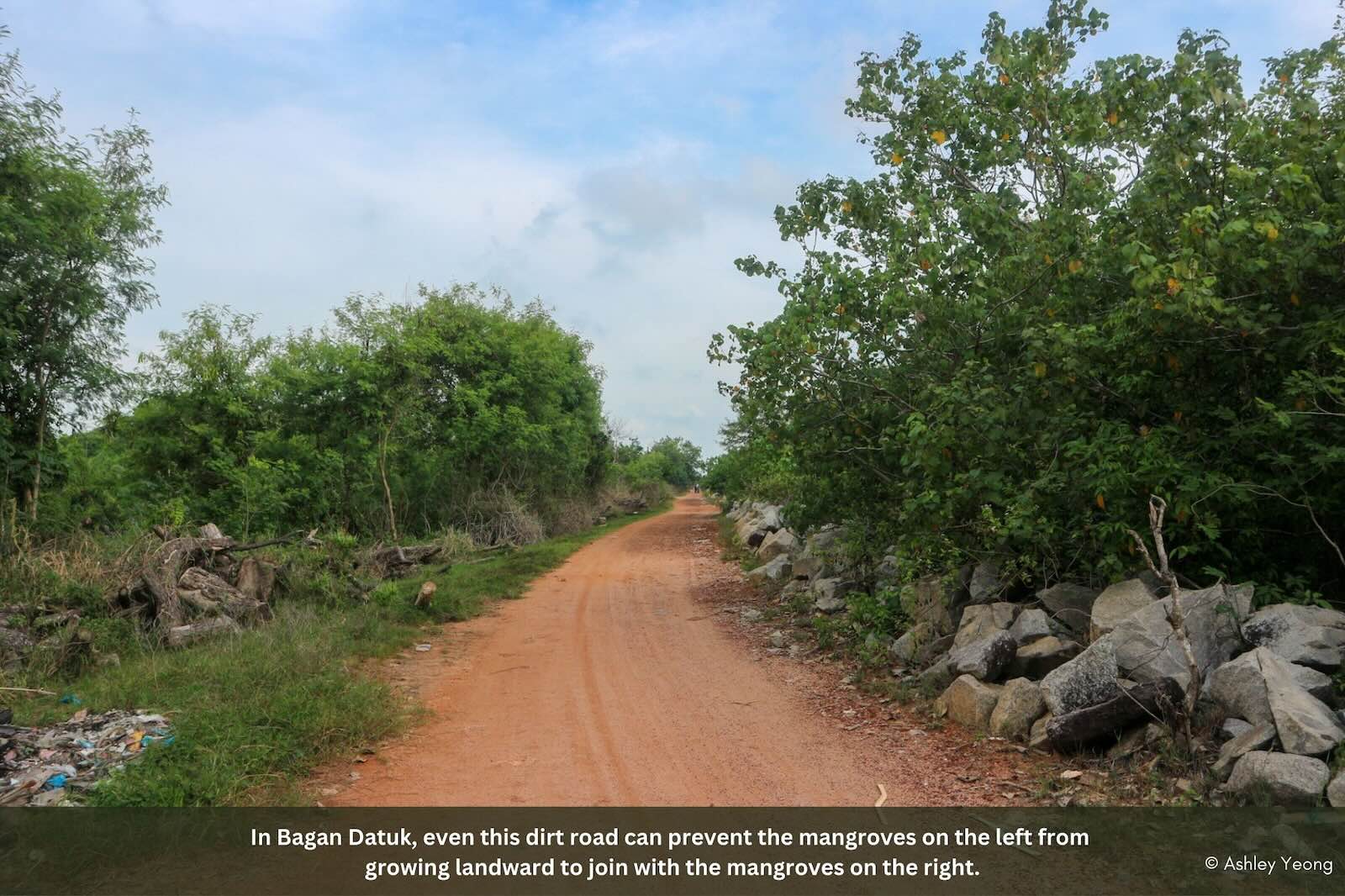
Ideally, back mangroves would merge into dryland forest. However, in reality, their ecological succession is blocked by a slew of man-made impediments. These include roads and plantations, aquaculture farms and landfills, and factories and ports. Often, these fragment the very mangroves themselves.
And when mangroves are degraded or lost, society and the environment suffer. The consequences grow ever more severe as Malaysia’s sea levels are set to rise with climate change. Already, Malaysia has lost plenty of mangroves.
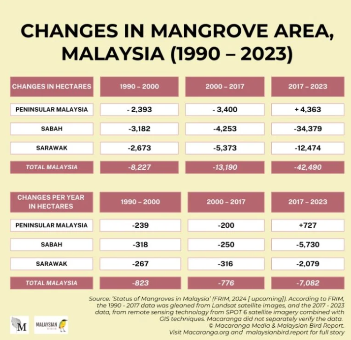
Many of Malaysia’s mangroves are actually legally protected: of its 586,548 ha, 93.74% are inside permanent reserved forests, and state and national parks. But Malaysia has been losing its mangroves steadily since 1990, according to the Forest Research Institute of Malaysia (FRIM) in its upcoming 2024 report on the status of mangroves shared with Macaranga.
While loss can also result naturally, FRIM states that the most loss is caused by development outside protected areas, on state lands. The biggest loss of mangroves took place in the last 6 years, since 2017.
Mangrove areas decreased by 46,853 ha, almost twice the size of Kuala Lumpur. Of this, a massive 73% (34,379 ha) happened in Sabah, and the rest in Sarawak (12,474 ha).
Measured in terms of loss per year, Sabah lost about 19 times more mangroves than in the previous 27 years, and Sarawak, at least 8 times more. Both these regions are home to the most mangroves in the country – Sabah around 22% and Sarawak 59%.
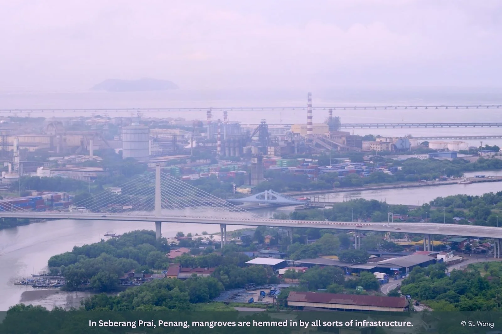
Interestingly, Peninsular Malaysia actually gained 4,364 ha of mangroves, more than making up for the mangroves it lost between 2000 – 2017. The losses and gains differed across states, but most states saw mangrove areas grow. Still, the earlier mangrove loss is evident. Driving from Penang to Selangor, outside of the protected areas, Macaranga found most mangrove forests little more than strips fenced by infrastructure and agriculture.
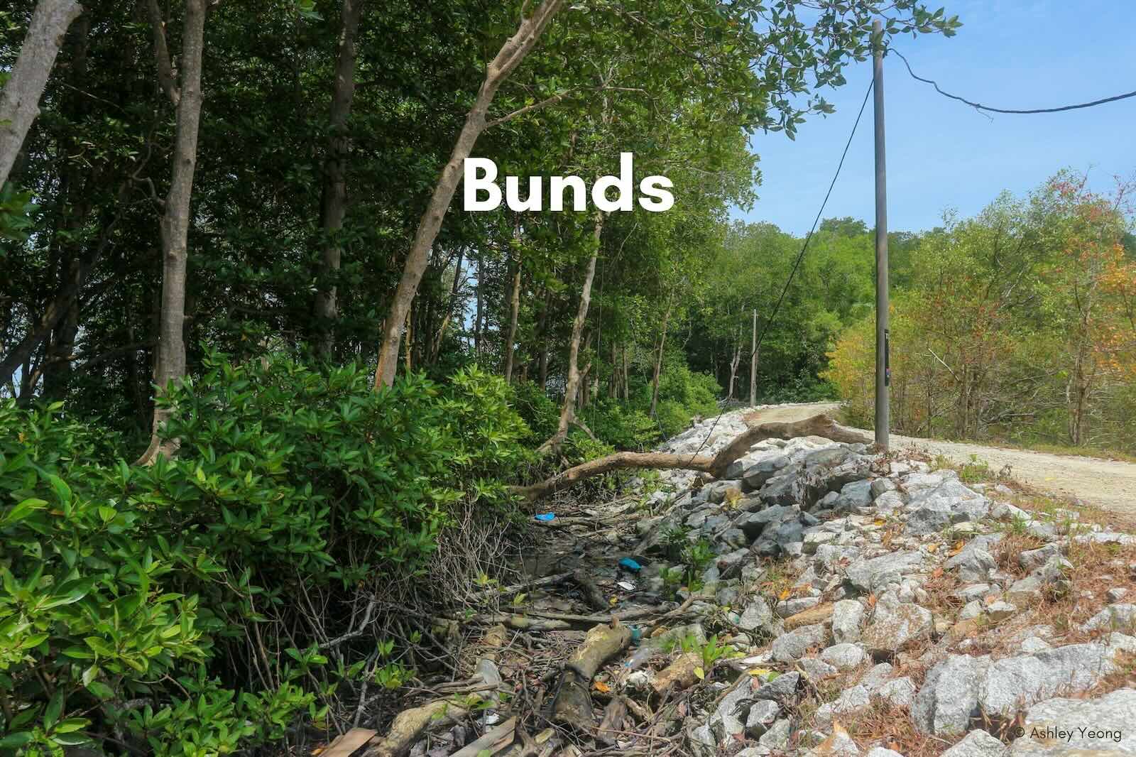
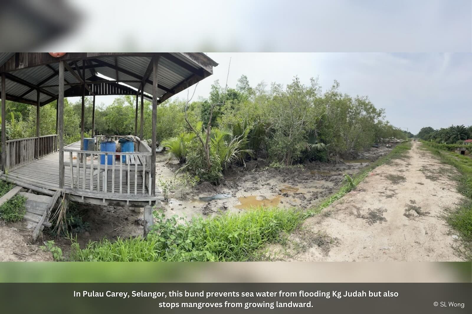
When agriculture is developed behind mangroves, bunds are typically built to shield plots from tidal flooding. To protect the bunds from eroding, the Department of Irrigation and Drainage has a policy to maintain a strip of mangroves between the bunds and the sea. But the bunds cause the mangroves themselves to erode.
Still, even in these mangrove strips, there is enough avifauna to draw bird-watchers and photographers.
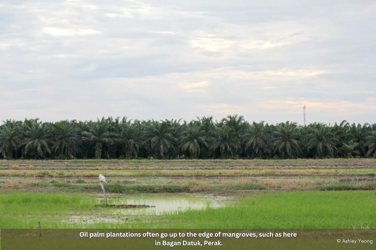
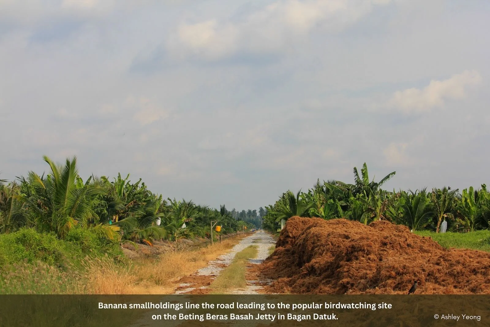
South of Matang in Bagan Datuk are the popular Beting Beras Basah jetty and Kampung Sungai Tiang. To get there, bird-watchers must drive through long stretches of oil palm plantations.
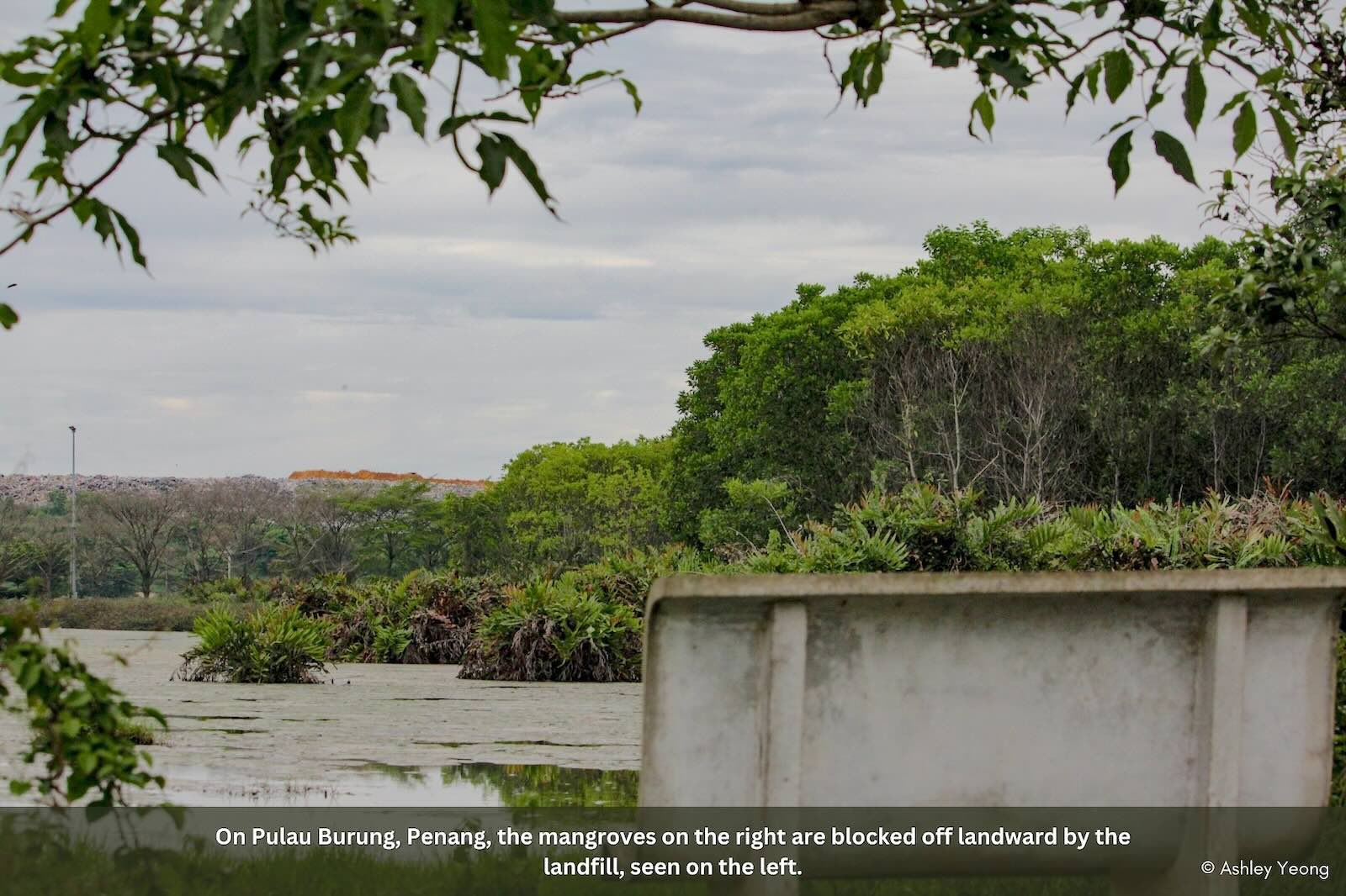
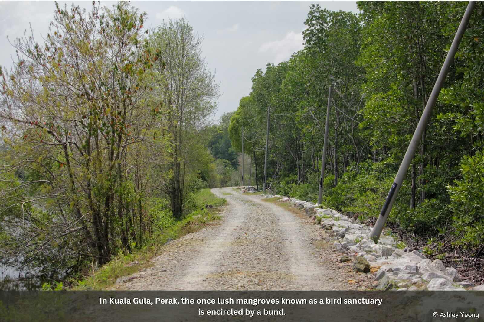
North at the bird sanctuary of Kuala Gula, they must pass aquaculture ponds that ring the mangroves. Here, the forest fringes the coastline, but only roughly 50m wide. A road around the ponds cuts through the back mangroves, fragmenting the habitat. Even further north in Penang, the mangroves of the once-aptly named Pulau Burung draws bird-watchers. This is despite its back mangroves having been replaced by a mountainous 16 ha landfill. Flood researcher Edlic Sathiamurthy says “during heavy rain, the leachate pond can overflow,” bringing toxic leachate into the mangroves and ocean. He personally observed this in 2017.

The critical point about cutting off mangroves from expanding landwards is that it throttles the health of mangroves, and their superpower to protect coasts and inland areas. Mangroves can gradually expand landmass from soil or sand deposits caused by the movement of water. Their dense root systems trap sediments carried by tides and rivers, gradually building soil. But mangroves need room to perform their ecological functions effectively, says Dr Chee Su Yin who researches coastal ecosystem conservation.
“If the sea level rises, they can move backwards. And if they have enough soil they can also move (forwards) towards the sea.” By this logic, mangrove areas should be protected to allow them to grow both seaward and landward. This has big implications as Malaysia’s sea levels are set to rise with climate change.
“But mangroves can only grow backwards if there is space,” points out Chee. How much space exactly? Ideally, as much space as possible. In reality though, she notes that the buffer zone is usually a mere 100 m. “This area (back mangroves) is always a tussle between developers and profit-makers and conservationists. One hundred meters is actually not enough. For me, I would advocate for at least 200 m to half a kilometer.”
But she concedes that “space is very precious. If you’re in the developers’ camp, then you want to use this space to develop. There’s a lot of money involved.
That’s where the difficulty of conserving mangroves is. It’s always been the developers and conservationists. Whether it’s mangroves or coral reefs, this is always the issue. –Dr Chee Su Yin
Birds as Red Flags
Without space for back mangrove expansion and the forest’s ability to host all its various zones, birds are at risk. Macaranga compared bird diversity and numbers at 2 sites in Perak 100 km apart, using the citizen birdwatching global database, eBird at Cornell University.
The Matang Mangrove Forest with its healthy forest complete with back mangroves has considerably more different bird species than Bagan Datuk, which only has a sea-front mangrove fringe (see table). In terms of resident bird species spotted, Matang has 96, more than double the 45 species in Bagan Datuk.
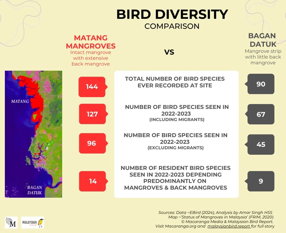
Narrowing it down to birds that live predominantly in mangrove habitats, Matang still has one-and-a-half times more different bird species than Bagan Datuk (mouse over the photos in the gallery below; tap on mobile). In 2022—2023, the majority of resident birds are more commonly seen and in larger numbers at Matang with its extensive back mangroves.
Unfortunately, in the thinner mangroves of Bagan Datuk, species such as the Mangrove Pitta Pitta megarhyncha, Mangrove Whistler Pachycephala cinerea have not been recorded in recent years; the birds were absent in both the 2024 eBird database and the 2018 MNS surveys.
Avian ecologist Noske, in his study of mangrove forest birds in Peninsular Malaysia, noted that birds like the Mangrove Blue Flycatcher have a “preference for dense forests with low light levels”. Hence its absence where the forest has ‘gaps’ or is sparse.
Ensuring the existence of birds in mangroves can actually help mangrove conservation – through ecotourism. Mangrove forests are under-appreciated as ecotourism sites. In recent decades firefly watching, for one, has grown. The top firefly-watching site in Malaysia, Sungai Klias in Sabah, draws 100,400 tourists annually. MNS in 2018 estimated that the economic value of the Teluk Air Tawar-Kula Muda coastal mangrove region at USD6 million per annum (RM28 million); USD760,000 (RM3.5 million) from nature-based tourism.
Drawing bird-waters and photographers can further boost the case for mangrove conservation. In Sabah, which saw the biggest mangrove loss in the last 6 years, 35% of tourists visited for ecotourism, including bird-watching in pre-pandemic 2019. The year before that, the state earned RM8.3 billion from 3.9 million tourists in tourism revenue. The Sabah Tourism Board also recognises bird watching as a niche market in tourism.
For ecotourism to thrive in mangrove forests, so must birdlife. And birds need healthy multi-zone mangroves.
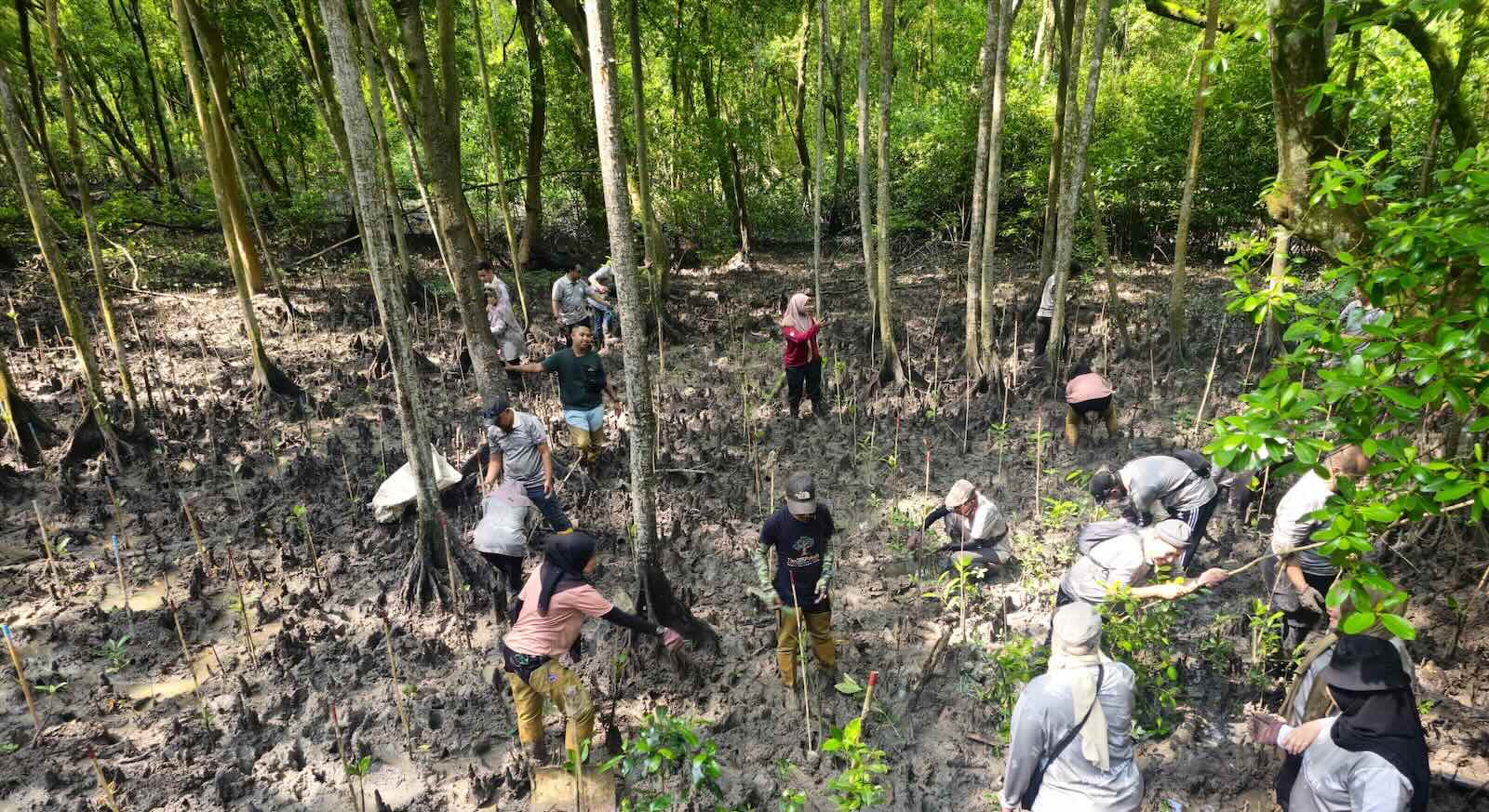
At Mangrove Point, Selangor, seedlings are planted landward-facing and their growth monitored. Photo: Selangor Maritime Gateway via Macaranga
Symbiotic Conservation
To boost mangrove’s land building capacity, restoring is a key activity in Malaysia. “Replanting really started after the tsunami in 2004,” says mangrove researcher Aldrie. The Indian Ocean tsunami of 2004 struck the coasts of several South and Southeast Asian countries, including Malaysia. The disaster killed at least 225,000, of whom at least 68 were in Malaysia.
Recognising the role mangroves played in mitigating the tsunami, Malaysia started the Programme for the Planting of Mangrove and Other Suitable Tree Species Along the National Coastline. From 2005 to 2022, 7.2 million seedlings were planted along coastlines, covering 3,278 hectares.
“The government and companies have a lot of money and they want to do replanting,” says Aldrie. But oftentimes, they do not engage with the scientific community and local communities. The result is ineffective or failed replantings. “They plant the wrong species and [on] the wrong site,” says the scientist. “You plant thousands of seedlings, and it’s washed away the next day.”
The idea is to establish an ecosystem. “We want to reforest, not just replant. Actually, if you let mangroves thrive naturally, they can regrow by themselves.”
Chee, the coastal conservationist, shares the same sentiment. She shares a powerful example of how Penang’s Gurney Drive reclamation had a “happy side effect”. While the developers were piling on sand to reclaim land, it created the perfect environment for mangroves to regenerate.
“It was muddy, sheltered,” she says. “The waves couldn’t get in but the seawater could. So because there was this really ideal situation in where the salinity was right, and there were these bunds stopping the waves from coming in. “And [in the] little space that the mangroves used to be, the propagules started to migrate. In 6 months, you can see that mangroves from a small area [spread] about 200 m down the Gurney Drive coastline. I thought this was really fast. Based on this observation, as long as the conditions are correct, then they can grow at a very fast pace.”
MNS also says that mangrove birds return to well-rehabilitated mangroves, calling their presence “an important indicator”. As elsewhere in the world, Malaysia’s mangroves are under tremendous pressure from competing uses, from agriculture to infrastructure. But what it takes for mangroves to support birdlife is what it takes to ensure they are healthy.
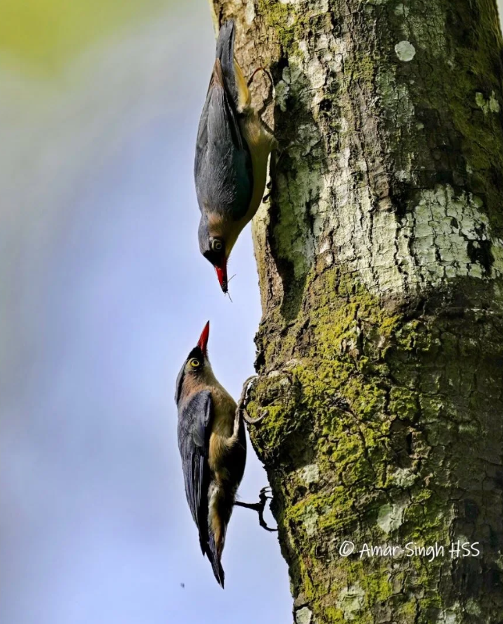
If healthy back mangroves are restored, Velvet-fronted Nuthatches might return to Selangor’s mangroves; Photo: Amar-Singh-HSS via Macaranga
This means having a mix of zones and enough space inland to undergo ecological succession to dryland forest, especially for the forest to survive as climate change raises sea levels. Chee says the discussion between scientists and policymakers is to allow these coastal forests room to migrate landwards; this means ensuring infrastructure like highways are not built too closely.
Ornithologist Wells was particularly worried about how the loss of back mangroves in Selangor had already led to a drop in bird diversity. The good news is that mangrove area has seen a net increase in the states featured in this article: Selangor (21 ha), as well as in Perak (58 ha) and Penang (124 ha) (see graph above).
At Bagan Datoh, Perak, both MNS and FRIM are working to conserve and enrich the remaining mangroves, working with local communities and developing ecotourism, including establishing an on-site mangrove germplasm facility.
All these would certainly augur well for the Velvet Fronted Nuthatch. This blue tree hopper has not actually disappeared from Selangor, as it has been spotted in other forest types. But perhaps one day, if Selangor’s mangroves – and especially its back mangroves – revive, the bird could actually return to its favourite habitat.
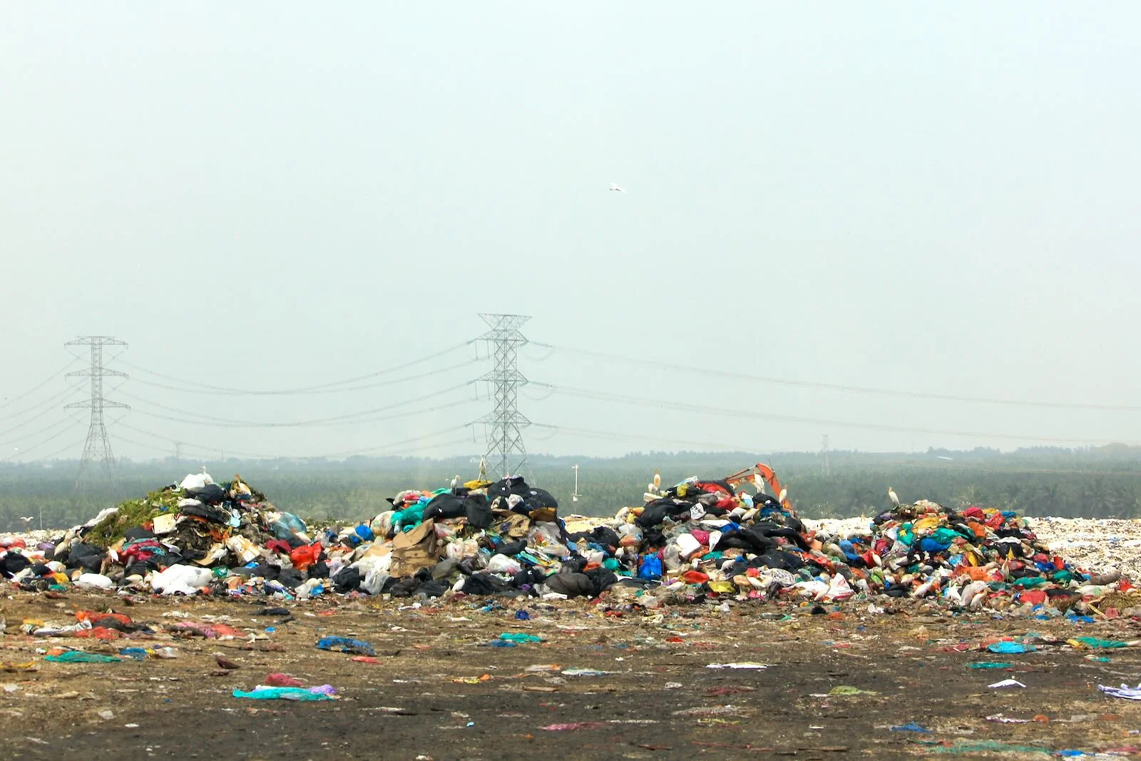
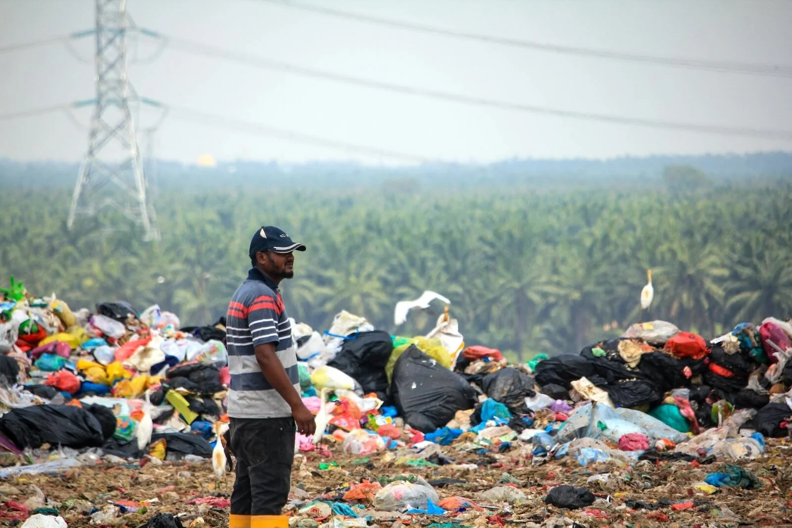
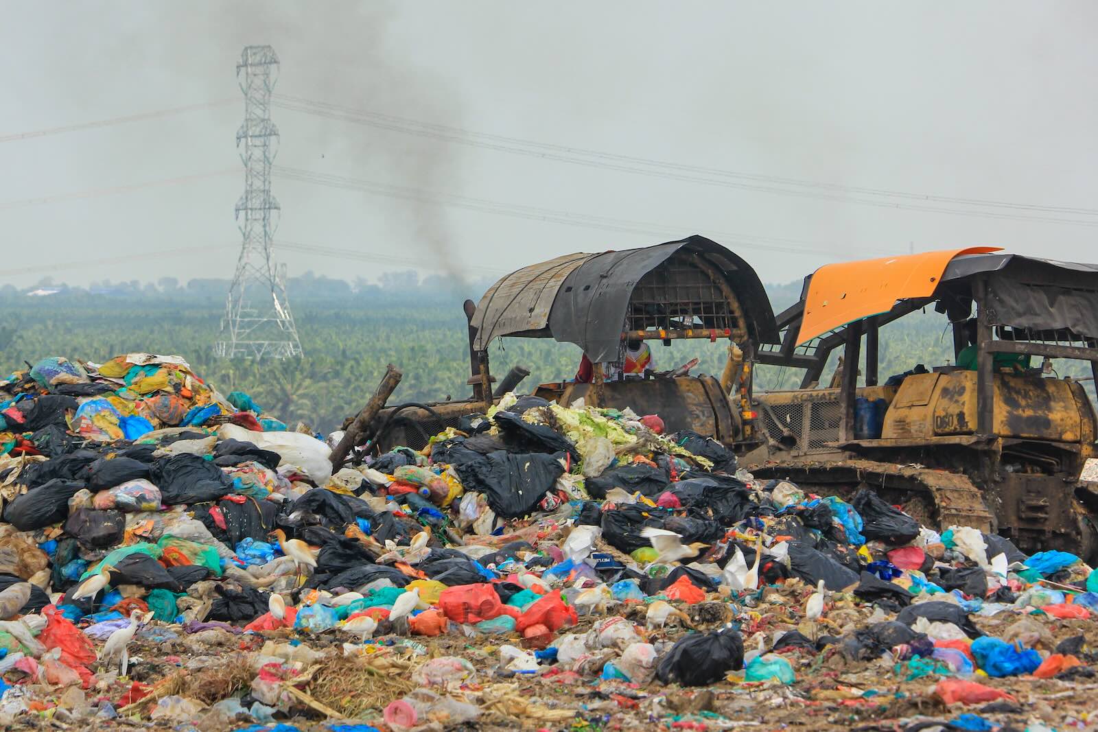
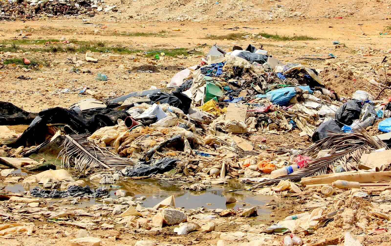
The landfill looms like a Titan, 27 meters into the sky, a stark symbol of Malaysians’ mounting waste problem. That is as tall as a 4-storey building. Its decaying mound emits a foul stench, all from the waste we generate.
This is the Jeram landfill in Selangor, which receives waste from 6 local councils in the Klang Valley. Within 10 minutes, 30 trucks unload their contents onto the ever-growing heap. Every day, 1,000 rubbish trucks dump on average, 3.7 million kilograms of waste into the landfill.
But far away from where anyone lives, it allows us to adopt the mantra of ‘out of sight, out of mind’. As Malaysia’s population not only grows but aspires for better living standards, we also generate more waste. With each passing day, our land disappears under ever-expanding mountains of trash, while toxic leachate seeps into the earth and poisonous landfill gasses taint the air.
And these are likely to worsen as climate change increases the frequency and intensity of floods, sea-level rise, and droughts. Good waste management is therefore urgent. How can we mitigate these harmful effects?
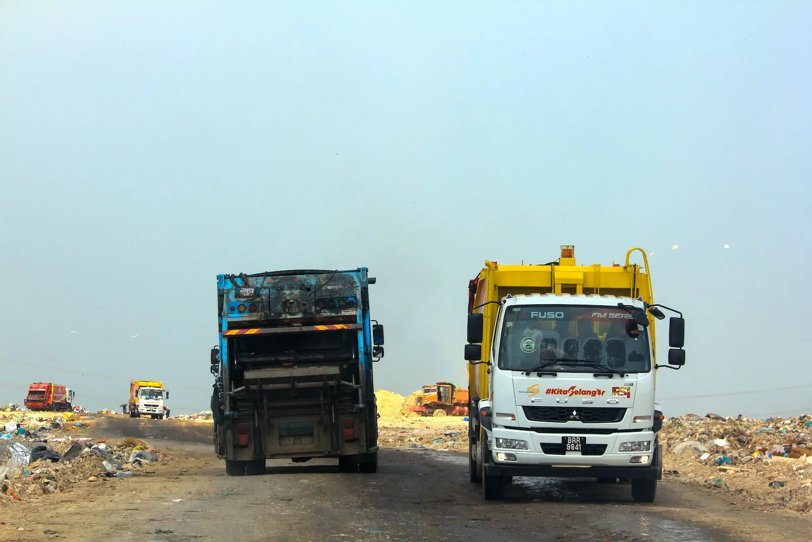
Every day, 1,000 rubbish trucks enter the Jeram landfill. They dump 3.7 million kg of rubbish on average. Built to last 20 years, the Jeram landfill will approach its limit in 2027. Once it’s full, new land has to be opened up; to avoid this, its operators are opting for an on-site Waste-to-Energy plant.
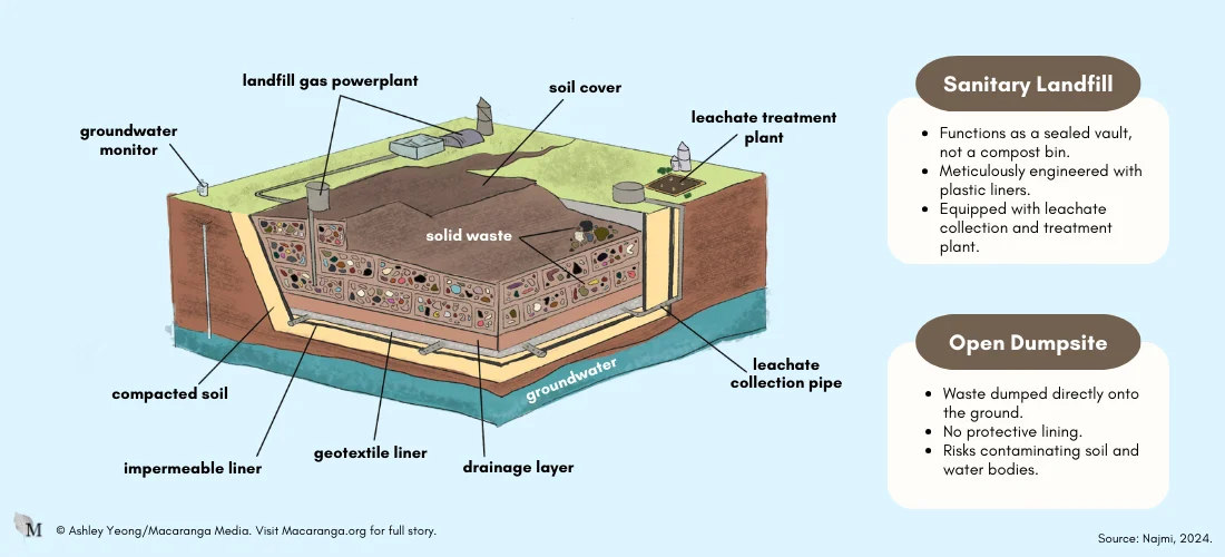
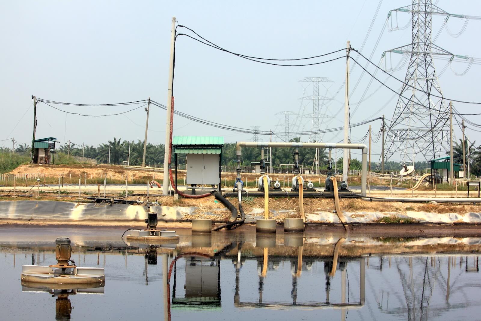
Managed by Worldwide Holdings, the Jeram landfill is a sanitary landfill. A sanitary landfill does not function like a compost bin, but like a sealed vault for waste. Once a landfill is filled up, the rubbish inside is meant to be locked away forever.
In fact, sanitary landfills are meticulously engineered and managed facilities, featuring a plastic liner to separate waste from soil and equipped with leachate collection and treatment systems.
In stark contrast, open dumpsites have no such safeguards. Waste is deposited on the ground, left to fester and decay. This leaves an unchecked flow of waste and leachate to freely contaminate the surrounding soil and water bodies.
-
Anatomy of a Landfill
A large hole is dug, and at its base, a polyethylene liner is sandwiched between layers of compacted soil to reinforce its structure, preventing leachate from seeping into groundwater.
Above the polyethylene liner, a geotextile liner is installed to add another protective layer and prevent damage to the plastic lining.
A network of pipes is installed at the bottom of the hole to collect leachate and channel it to a treatment facility. Pipes are also installed to capture methane emissions from the landfill.
Waste is compacted to save space and deposited in layers within the hole. Soil is added as cover after each layer to contain odours and deter pests.
When the landfill reaches capacity, it is sealed with layers of clay, sand, and topsoil and monitored for several years or even decades to minimise potential risks to surrounding ecosystems and public health.
– Source: ‘How a Landfill Works’. YouTube, uploaded by WM.
Malaysia’s landfills were once all open dumpsites. Some were later converted to sanitary landfills. This conversion involves digging out rubbish and installing proper lining and treatment facilities.
But only 15 of Malaysia’s registered operational landfills are sanitary landfills. The remaining 116 landfills are dumpsites (Ministry of Housing and Local Government [KPKT], October 2023).
In addition, there is an unknown but probably large number of unauthorised dumps for household trash and hazardous waste. In February, the KPKT revealed that they closed 2,093 illegal waste dumping sites last year alone at a cost of RM1.6 million.
Without protective measures, dumps pose significant environmental and human health risks, heightened now by the climate crisis.
Garbage juice
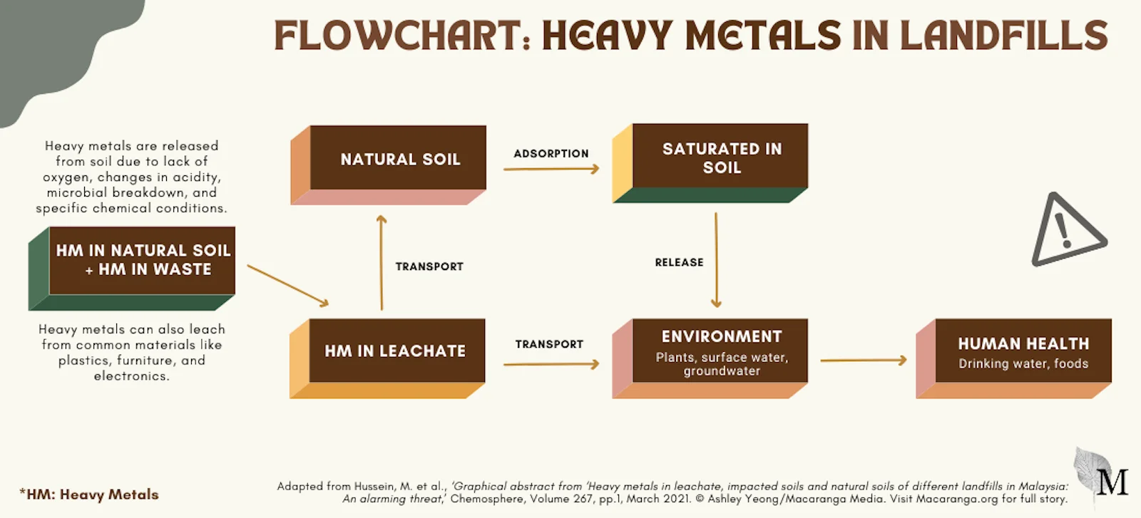
Leachate, often likened to “garbage juice”, forms when water seeps through waste, coming from rainfall or the waste itself.
A major concern with leachate is the concentration of heavy metals it carries. These toxic substances leach not only from electronic waste but also from common materials like plastics, wood, and everyday household items like milk cartons. They also already exist in natural soil.
Without bottom liners, leachate collection, or treatment systems, untreated leachate seeps into the soil and pollutes nearby waterways through runoff.
“Heavy metals are inorganic and non-degradable. They stay in the environment, remaining in the soil for many years,” says Dr Munirah Hussein, who has researched heavy metals in leachate. Unlike organic matter, heavy metals can persist within landfills for over a century.
Arsenic Worry
She says of the heavy metals, arsenic, one of the most toxic heavy metals, is most common. Arsenic is particularly alarming because it cannot be detected due to its odourless and tasteless nature.
As arsenic migrates from landfills into waterways, it can disrupt aquatic ecosystems and potentially cause cancer and other health problems in humans exposed to contaminated water.
“The solubility and mobility of arsenic are further exacerbated by increasing alkalinity (pH levels) and salinity (salt content) in groundwater and sediments, heightening the risk of environmental contamination.”
Climate impacts
Climate change is worrying, notes Munirah, as it brings increased floods and wetter days. Quite simply, the wetter the landfill, the more pollutants leach out of the waste.
“The critical thing is for sanitary landfills to have [a layer of soil on top] to reduce direct contact of waste with rainwater,” she says.
-
Floods mean more rubbish
Climate change-induced floods add tremendously to flood-related waste, says Thing Siew Shuen of Greenpeace Malaysia.
2024: Kota Tinggi, Johor saw the disposal of 90,000 kg of flood waste
2021: the Taman Sri Muda flood in Shah Alam saw 5 mil kg of flood waste
2017: Penang had to deal with 10 mil kg of waste within just 10 days
Hydrology expert and flood researcher Edlic Sathiamurthy agrees, noting that a warming Malaysia can also intensify heavy metal leachate risks.
“Higher-than-average temperatures can make chemical processes more active. Leachate is a cocktail of all kinds of materials,” he says. “We have not even factored in air pollutants causing acidic rainfall, [which] would further react with the rubbish.”
Coastal dumps at risk
Another climate change impact of concern is rising sea levels. These pose a problem for coastal landfills, allowing water to seep in and carry leachate into the ocean. This would harm marine ecosystems and lower water quality.
This is the case for the 16ha Pulau Burung landfill in Penang, says Edlic, who grew up near that landfill. He gestures at a map of the landfill and humorously points out a gazebo along a running track. “You could sit here and smell the fresh air of rubbish,” he says cheekily.
But turning serious, he says that Pulau Burung’s coastal location has become a real problem.
Overflowing leachate
“During heavy rain, the leachate pond can overflow. But with climate change, it’s not just about rain – it’s also about sea level rise, wave height, and storm surges,” he explains.
During spring tides and storm events, waves can reach further into land, flowing into the leachate pond.
The threat from rising sea levels is not limited to Pulau Burung, he warns. “If it’s an old landfill in a coastal area, then it is subjected to the same problem. Can you imagine an event like that? Water overtops, mixed with the leachate, and goes back into the sea!”
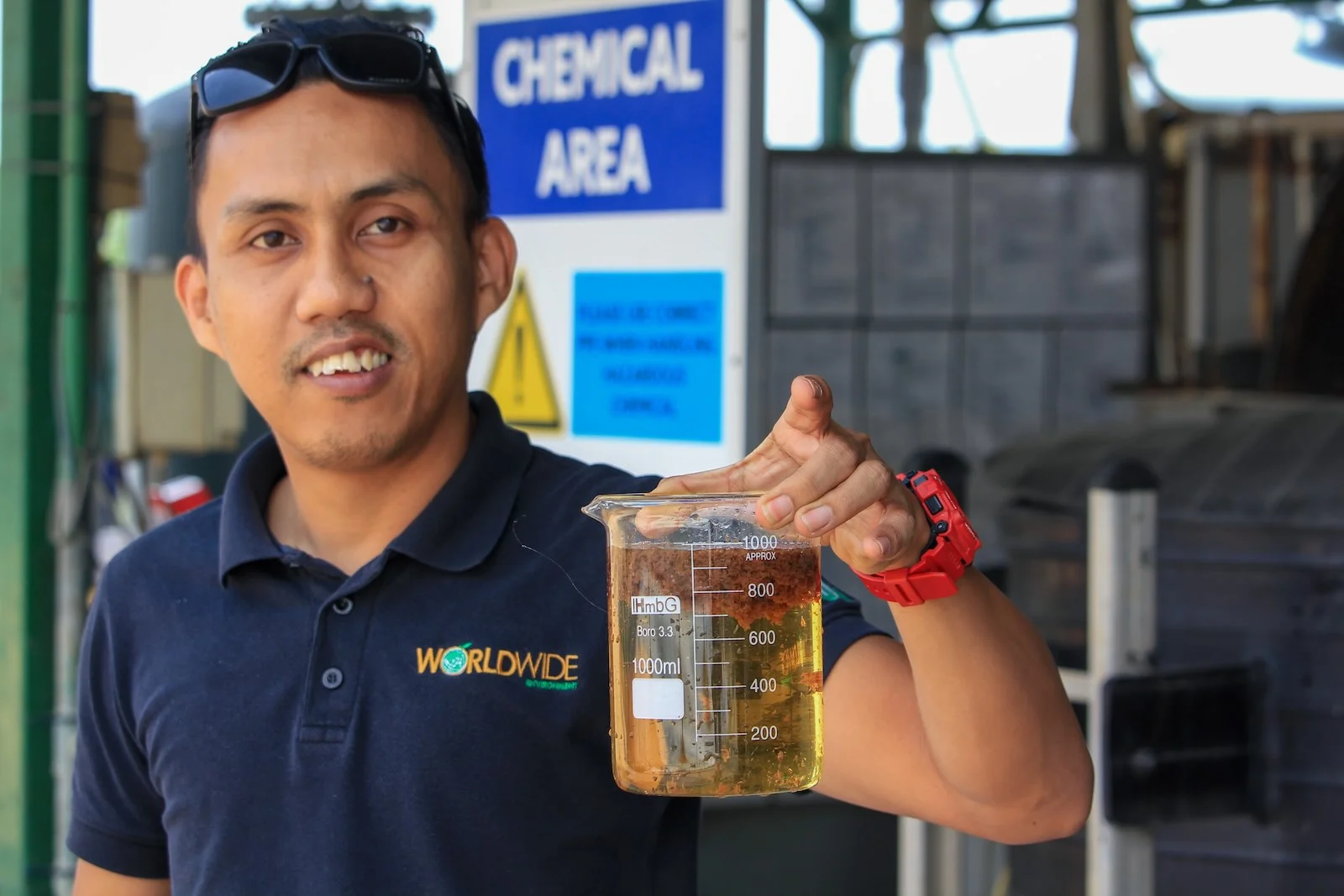
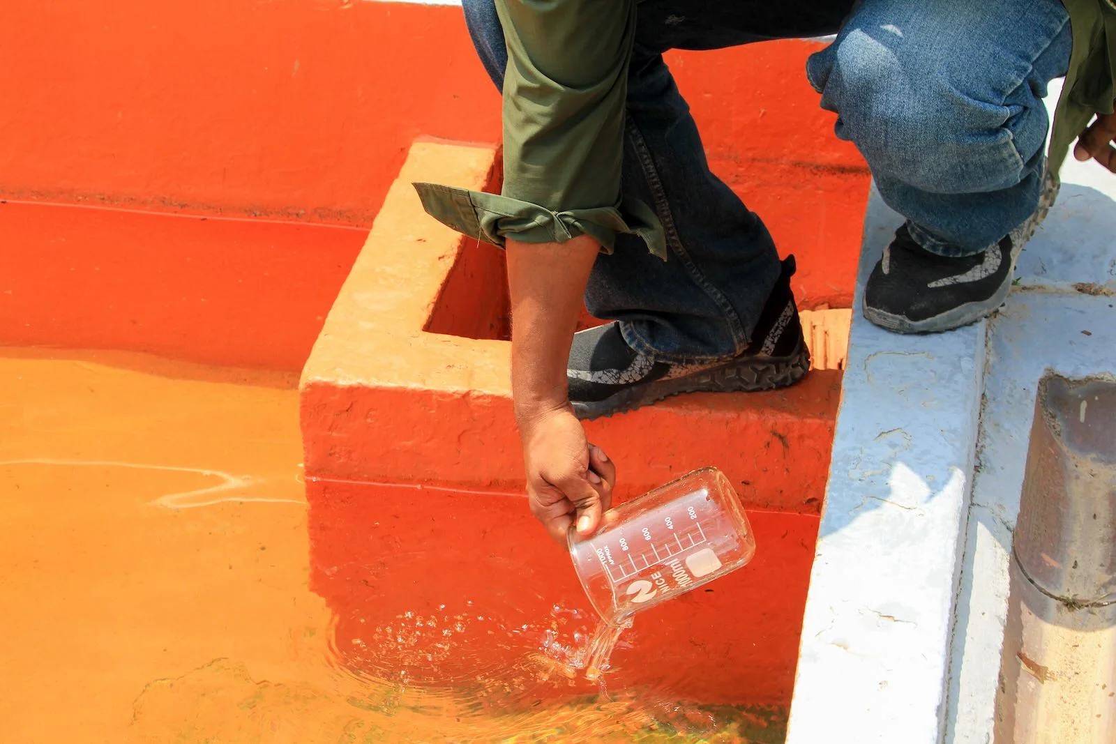
(1) Leachate seeps out of rubbish and can contain heavy metals. (2) In a lined sanitary landfill, leachate is collected, aerated and treated. (3) During treatment, leachate goes through rigorous pro-cessing, eliminating solids and sludge. (4) The liquid is tested for signs of contamination. (5) Once the process is completed, the liquid is released into nearby waterways. Photos: Ashley Yeong/Macaranga

Fire risks grow
As temperatures rise with climate change, so does the risk of landfill fires. On a hot and dry day, only the landfill’s bottom may be in contact with water, explains Edlic. “The top is dry. As materials decompose, methane gas builds up, potentially causing explosions”.
Pulau Burung alone has caught fire multiple times, fires which are tough to extinguish if they are sub-surface; in 2022 fires there took up to 3 weeks to extinguish.
With warmer days, the risk of landfill fires increases, warns NGO Environmental Protection Society Malaysia’s vice-president Randolph Jeremiah.
Gas Buildup
“Prolonged drought is a major contributor [to] heat buildup within a landfill. The presence of methane increases the intensity of a fire.” He cites past fires in the Bukit Bakri Muar landfill and Pekan Nenas Pontan landfill during the 2018 drought.
What’s more, when landfills catch fire, they release dangerous pollutants into the air, causing health problems like respiratory issues. In March, a landfill fire in Kota Kinabalu forced nearby schools to close early and students to wear face masks because of poor air quality and hotter temperatures.
The siting of new waste facilities should consider climate risks like droughts, floods, and sea level rise to minimise operational and environmental risks, says Jeremiah.
-
Landfills generate heat themselves
In landfills, various chemical reactions, like metal corrosion and hydration, generate heat within the waste. However, there is not yet a full understanding of how fast these reactions occur or how much heat they release.
By themselves, these reactions aren’t likely to create high temperatures across the landfill. Instead, heat may accumulate in certain spots due to a mix of microbial and chemical reactions.
This localised heat buildup, along with poor gas removal and possibly increased pressure, could trigger a change from absorbing heat to producing heat in a process called pyrolysis.
Filling up fast
The problem is not just in properly lining and treating waste in landfills. Worldwide Holdings, who manages the 117ha sanitary landfill in Jeram, reports that landfills are nearing capacity much earlier than expected because trash is growing so fast.
For example, in 2021, it had to take in an additional 5 million kg of waste from Shah Alam’s Taman Sri Muda flood alone.
Once full, new land would need to be opened for new landfills, or alternative waste management methods explored. Worldwide’s solution is incineration, or Waste-to-Energy (WtE) plants.
“With WtE, [our landfill] can go for another 20 years,” says Najmi Mohamad Saifullah, senior engineer at Worldwide.
Worldwide’s WtE facility which is being constructed, is Malaysia’s largest. The 12ha facility will be in Jeram and is expected to start operating in 2026. It will be able to generate up to 52 MW of energy for the national grid, roughly 410,000 households.
Burning Waste Viable?
As the land available diminishes, incineration emerges as an alternative. In Malaysia, plans for 7 WtE facilities are underway.
However, Greenpeace Malaysia’s Thing Siew Shuen cautions against this approach, calling instead for a shift towards sustainable lifestyles. Without addressing excessive plastic and food waste at the production stage, any solution remains incomplete, Thing argues.
“Whether it’s landfills or incinerators, the continuous investment in these facilities represents a misallocation of public funds and mismanagement of resources.
“Sending waste to landfills is akin to draining water from a flooded bathroom without first turning off the tap. Excessive plastic and food waste could be significantly reduced at the production stage, for instance, by replacing single-use plastics with reusable and refillable options.”
Tackling GHG
But Najmi points out WtE’s added plus: reducing greenhouse gas emissions. Landfills emit methane, a greenhouse gas that is 28 times more potent than carbon dioxide. He says the simplest way to reduce the amount of methane being released into the atmosphere is to burn it and turn it to carbon dioxide.
But carbon dioxide is also a greenhouse gas: burning one kilogram of municipal waste emits carbon dioxide to the tune of 0.7 to 1.1 kg.
Nonetheless, Worldwide also collects the landfill gases to generate electricity.
Much more to be done
Greenpeace’s Thing looks forward to a time without landfills as society embraces sustainable lifestyles.
“Can we envision a future where more landfills are closed, as more people reject single-use, throwaway, and convenience-driven lifestyles in favor of reuse and refill practices?”
Worldwide’s Najmi actually agrees. “I won’t call myself a recyling freak, but looking at all the waste, I definitely try to sort out my plastic,” he says with a wry smile. Being in the waste management industry for more than a decade has influenced his daily lifestyle choices.
Edlic echoes this sentiment. “Plastic takes years and years to decay. Why do we have waste in the first place? It’s because of the inefficient use of resources, and our consumption behaviour.
“We have many things that we don’t actually use and don’t actually need. There has to be a paradigm shift in how we consume, along with stakeholders, industries and the commercial sector, to change.”